Update: As of 3/27/11 detailed images of the affected areas of Japan after 3/11 are now available on Google Earth. I have not included any of these here however.
The impact of the 3/11 Japan earthquake and tsunami was extensive. Searching online and using Google Earth I was able to find a few before and after photos of the region surrounding the ceramic workshop. While the before images contain photos of the workshop, the after images unfortunately are of regions within a mile of the workshop, but do not show the workshop and only structures and areas nearby.
Please click on the images as they link to much larger pictures with greater detail
. This workshop lies about 47 miles from Fukushima I nuclear power plant. By far, the most widely circulated image of Iwanuma after 3/11 is a
picture of the coast looking toward the south with Abukuma river in the upper quarter of the picture and the tsunami rushing ashore.
 |
| The red arrow indicates the workshop with outbuildings (white and blue roofs), this is before 3/11. |
 |
| Zooming out of the above photo, the workshop is in upper left. |
 |
| This is after 3/11. The workshop is just barely outside the left of the frame; making it clear that it was affected by the tsunami. |
 |
| Another aerial view of Abukuma river before 3/11, workshop is at far left center. |
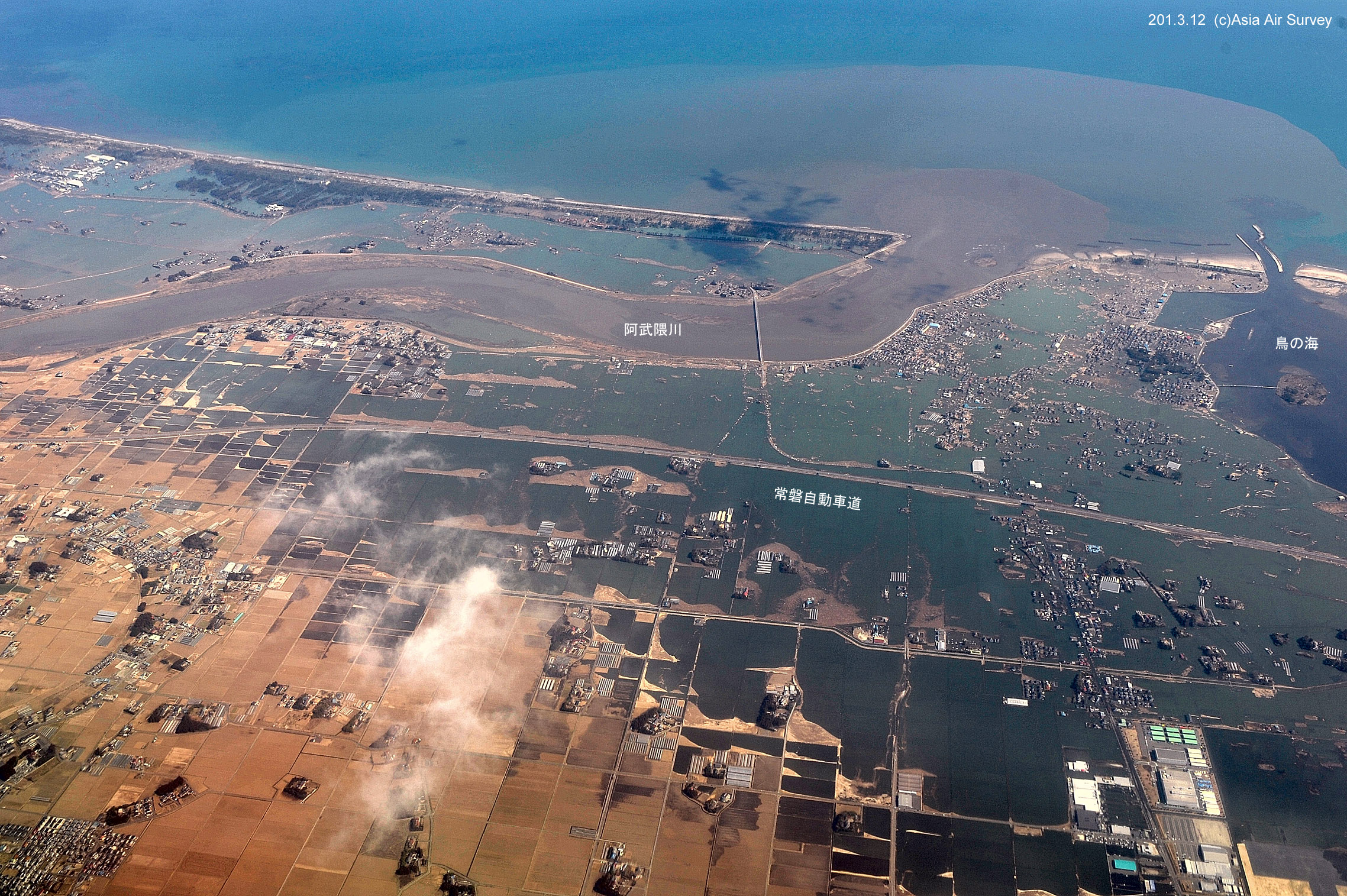
 |
| Image of Abukuma river after 3/11. |


Just terrible. I didn't know they were so close to the reactor, either.
ReplyDelete